Satellite navigation jamming is a growing concern in the Asia-Pacific. Fortunately, there are steps nations can take to mitigating this menace.
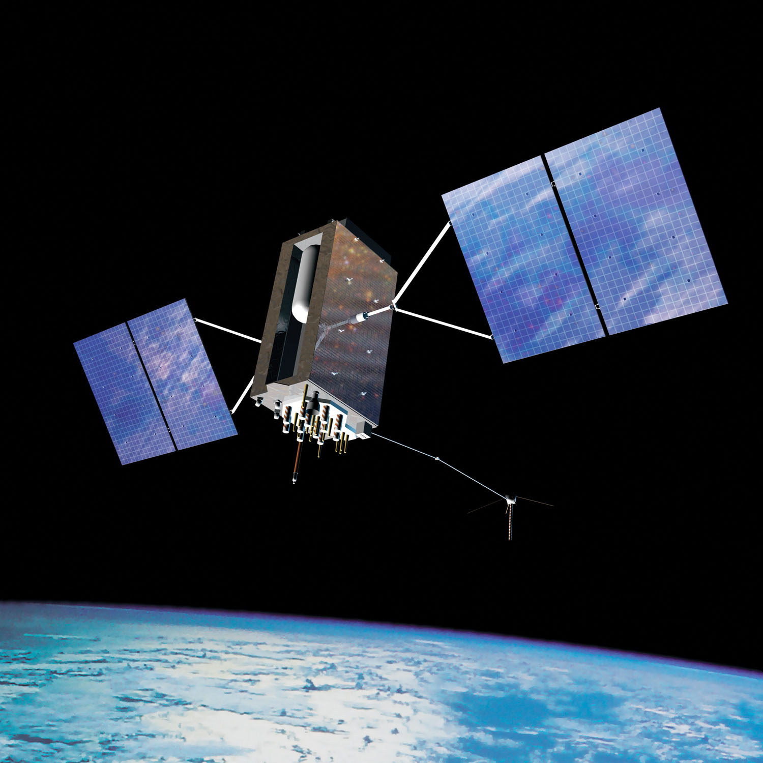
A satellite navigation signal travels along to reach us. The US’ Global Positioning System (GPS) has a constellation of satellites positioned approximately 20,200 kilometres (12,550 miles) above Earth. Their signals have a strength of 54.8 decibels/milliwatt (dBm) when they leave the spacecraft. When they reach Earth, these signals will have reduced to a strength as low as -130dBm. The lower the dBm number, the weaker the signal. This explains why GPS signals get easily blocked by large buildings in urban areas and by thick tree canopy in a forest or jungle.
Why are these signals so weak? They must travel a long way to reach Earth. Like a marathon competitor, the runner has far more energy at the start of the race than at the end. Signals are also weak as they are generated by a satellite’s solar panels and because the spacecraft are transmitting continuously. Furthermore, space is a finite resource on a satellite. A balance must be struck between the mass of the satellite’s electricity generation equipment and its size and weight so it can be safely and economically launched. The net result is weak GNSS (Global Navigation Satellite System) signals which are easy to jam and spoof.

Nefarious Actors
Spoofing is a growing problem in the Asia-Pacific. In June 2021 Katie Zeng, north, south and central Asia analyst for Risk Intelligence penned an article entitled ‘GNSS Spoofing in China and Beyond’. Zeng chronicled worrying incidences of GNSS spoofing in and around Chinese maritime interests.
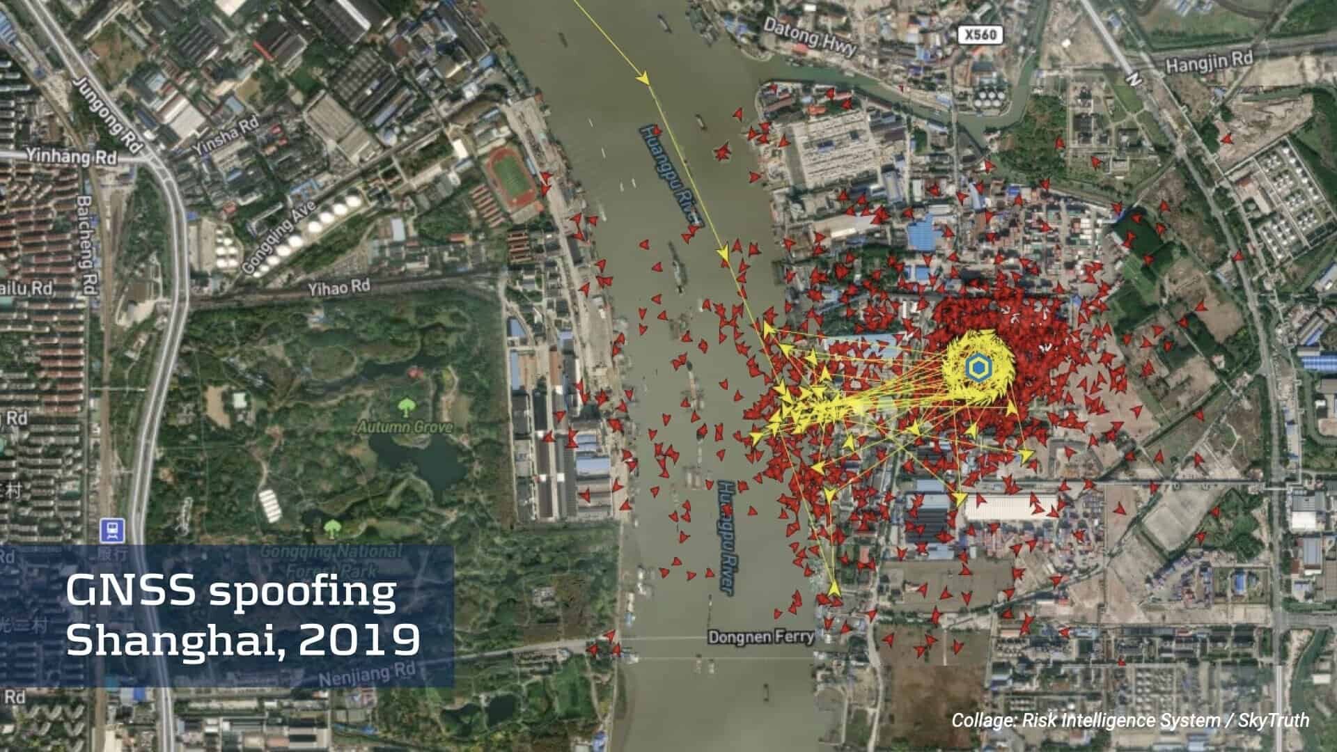
In 2019, GNSS spoofing was detected around Shanghai’s port on the People’s Republic of China’s (PRC) east coast. It took the form of vessel tracks being shown inland. Zeng wrote that the motives for manipulating the GNSS data and the identity of the perpetrators was unclear. Other incidents include the manipulation of GNSS data supporting Automatic Identification System (AIS) transmissions from shipping. AIS is mandated by the International Maritime Organisation for all ships displacing over 300 gross tonnage. Transponders send information on the vessel’s identity, voyage and route using maritime radio and satellite links. AIS transponders share positional information using the ship’s GNSS receiver. This data is visible to other ships and shore installations using AIS receivers. If this information is incorrect, either by accident or by design, then the ship can appear to be a completely different position from where it is. Zeng noted that a flotilla of Chinese fishing vessels altered their GNSS signals to show the vessels as being near New Zealand. In reality, they were near the Galàpagos Islands off Latin America where they may have been illegally fishing.
Zeng told AMR that the PRC “will use AIS data manipulation at central government officers and oil terminals in Shanghai, Dalian, Fuzhou and Quanzhou” along the country’s coastline. She believes that “one of the likely motives to carry out this GNSS manipulation is to cover the tracks of Chinese companies importing Iranian crude oil. However, this is just an assessment based on news of US sanctions on Chinese companies.” So far, it appears the jamming is only affecting the GPS constellation. Zeng says this is not surprising given the prevalence of GPS use globally. Exactly how much GNSS spoofing is going on in the Asia-Pacific is difficult to say: “Most of the time when people do GNSS spoofing, they are not looking to be discovered” says Dana Goward, president of the Resilient Navigation and Timing Foundation.

The PRC is not the only culprit. Over the past decade, the Republic of Korea (ROK) has suffered GNSS attacks open sources have blamed on the Democratic People’s Republic of Korea (DPRK). The Centre for Strategic and International Studies’ (CSIS) Space Threat Assessment 2021 report said the DPRK had inducted new anti-GNSS weapons into service. The CSIS is a think tank based in Washington DC. The report also noted DPRK GNSS jamming operations along the Korean peninsula in 2020. These attacks have been directed against civilian rather than military GNSS use. The DPRK government may wish to cause inconvenience and disruption without excessive escalation. Military GNSS jamming risks being construed as an act of war. While the DPRK can jam civilian GNSS, her capabilities maybe insufficient to jam the encrypted M-Code signals from the US GPS constellation used by US and allied forces. Goward notes that M-Code will help overcome some interference. However, it might not be a significant obstacle to a determined adversary, he warns. Likewise, he believes that the DPRK may be exporting jamming technology to other nefarious state and non-state actors.
Dependency
GNSS is indispensable for commerce and quality of life in the Asia-Pacific much as it is for anywhere else. It is relied on for navigation on land and at sea. Aviation also uses GNSS although aircraft also use terrestrial radio navigation systems to avoid being overly reliant on one form of navigation. It may come as a surprise to learn that GNSS is also used widely in the financial sector. Timing is a key element of navigation. You must know what time you left somewhere and your current time to determine your speed and location. GNSS satellites provide a time signal as part of their transmission. This is generated by the spacecraft’s highly accurate atomic clocks. The commercial sector relies on GNSS time signals to synchronise computer handling credit card transactions and e-commerce for example, says Goward.
Any major and sustained disruption to GNSS signals in the Asia-Pacific could have serious ramifications for the region’s economies. The United Nations’ (UN) Economic and Social Commission for Asia and the Pacific (ESCAP) estimated that in 2021 the region accounted for 41 percent of the world’s imports. It also accounted for 36.8 percent of the world’s exports.
In late March 2021 the Ever Given container ship got stuck in the Suez Canal blocking the waterway for six days. Maritime insurer Lloyds of London estimated the ship was holding up $9.6 billion of trade daily. Imagine the cost of widespread GNSS disruption hitting commercial shipping in the South China Sea. According to the Australian Strategic Policy Institute think tank over 30 percent of goods carried on the oceans move through the South China Sea.

Mitigation
What can be done to mitigate the potentially devastating consequences of widespread GNSS jamming in the region? The first step is to detect the jamming in the first place. This is vital. By the time people realise something is wrong, the disruption may have been going on for several hours.
In August 2021 it was reported Spire Global’s constellation of circa 150 Lemur nanosatellites can detect GNSS jamming. Nanosatellites are traditionally defined as having a mass of between one and ten kilograms (2.2 and 22 pounds). The company revealed that it had accidentally detected GNSS jamming signals while calibrating some of its satellites. Company representatives said that GNSS jammers tend to emit very high power levels. Although GNSS signals are weak when they reach Earth, this tactic ensures they are comprehensively jammed around the jammer’s locale. These ‘loud’ signals were relatively easy to detect with Spire’s satellites.
The ability to detect powerful military GNSS jamming will be very useful for actors in the Asia-Pacific. The origin of these jamming signals can be cross-referenced with satellite photos of the jammer’s location. This will give clues on the type of jammers being used and the nation performing the attacks. Governments can then make representations to the latter asking them to desist. At the same time, alerts can be sent to GNSS users in the vicinity of the jamming warning them what is going on.
The effects of GNSS jamming can be mitigated by using alternatives to provide the all-important PNT (Precision Navigation and Timing) information these signals transmit. One promising technology is known as ELORAN (Enhanced Long-Range Navigation). This is a vastly modernised version of the LORAN radio navigation system pioneered during the Second World War and in use around the world until 1990s. LORAN ultimately became a casualty of GNSS and largely fell into disuse.

ELORAN
“One of the best defences against GNSS jamming and spoofing is to have other ways to determine your position relatively accurately,” says Goward. The risk to GNSS infrastructure posed by jamming and spoofing has triggered a renaissance of interest in LORAN and a desire to augment it with new technology. LORAN was mainly used by aircraft and ships. LORAN stations were dotted around the world’s coastlines. It used an elegantly simple principle. All radio waves travel at 161,595 knots-per-second (299,274 kilometres-per-second). LORAN stations work in pairs. Maps showed where these stations were located and the distance between them. Each station would continuously transmit a single radio pulse on frequencies of 90 kilohertz/KHz and 110KHz. The pulses were transmitted every half a second. If a ship or aircraft is exactly midway between both LORAN transmitters, the pulses arrive at the same time. If the ship or aircraft is closer to one transmitter than the other, it receives pulses from the nearest transmitter slightly earlier than pulses from the farther one. Calculate the time lag between these two pulses, and you can calculate your position relative to the transmitters.
Goward says that ELORAN is vastly modernised and more secure that the erstwhile LORAN system. It has many more potential features as would be expected after more than 50 years of development across the electronics and information technology industries. Usefully, as ELORAN depends on accurate timing for the pulse transmission, it can be used as an alternative timing source to GNSS. For example, an e-commerce provider could use an ELORAN station in range for its time signal. ELORAN stations typically have ranges of up to 1,000 nautical miles (1,162 kilometres). Several of the Asia-Pacific’s big cities and financial hubs are near coastlines. This means that they could potentially be near LORAN stations. By upgrading these stations to ELORAN, their signals will stretch far inland as well as out over the oceans. This means that vehicles in range could also benefit from ELORAN coverage.
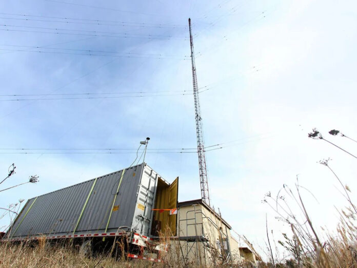
You do not even need to have a GNSS receiver on a building’s roof to receive ELORAN signals as these can penetrate buildings, unlike GNSS signals. This means if a company or organisation needs an alternative timing source, it can have the ELORAN receiver indoors on its premises. ELORAN signals are five million times more powerful than GNSS. They also use very low frequencies. Both these factors make ELORAN difficult to jam. Existing LORAN stations dotted around the Asia-Pacific coastlines which have fallen into disuse could be reactivated and upgraded for ELORAN. Moreover, companies like Hellen Systems have developed portable, containerised ELORAN systems. These can be used to provide ELORAN coverage where no existing ELORAN stations are available.
Countries in the region are embracing ELORAN. In 2020 the ROK government signed an agreement to use ELORAN to aid digital television and radio broadcasting. Contemporary reports said that these signals, which depend on GNSS timing, have been targets of DPRK jamming in the past. The agreement was concluded between the ROK’s Ministry of Oceans and Fisheries and the Munhwa Broadcasting Corporation. The ministry is the custodian of the country’s LORAN/ELORAN infrastructure. The ELORAN service provides timing information to the broadcaster. Munhwa meanwhile uses its networks to transmit GNSS integrity and correction information. In July 2020, UrasNav was awarded a contract to supply and install a testbed ELORAN system near Inchon on the ROK’s northwest coast.
Making the Commitment
ELORAN and Spire Global’s satellites are a step in the right direction to mitigate GNSS jamming and spoofing. It is important to note that there is no one single technology that will instantly forestall the disruption GNSS spoofing and jamming could cause. Instead, countries around the region and the wider world should adopt an assortment of technologies to address the threat. The imperative will be to spot jamming and determine its location and origin. Then, alternative PNT services will need to be activated. GNSS users must then be advised that satellite PNT services are unreliable and to use the alternatives. GNSS spoofing and jamming is a reality nations around the Asia-Pacific must live with for the foreseeable future. The sooner GNSS users in the region address the jamming and spoofing threat, the sooner these dangers can be mitigated. As Goward says “anything countries and GNSS users can do to make themselves independent and insulated from GNSS disruption of all kinds is a worthwhile endeavour.”
by Dr. Thomas Withington


